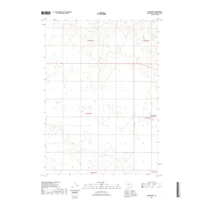
2017 Map of Harrington
USGS Topo · Published 2017About this map
Harrington stands as a primary point of reference in this South Dakota landscape, positioned along the eastern edge of Bennett County. The terrain is defined by the winding course of the Little White River, which meanders through the southern portion of the map, cutting across section lines and influencing the local topography. This area is organized by a clear grid of section boundaries, including t37n r33w, where the settlement is located. While the landscape is largely open, the presence of 294 St provides a modern corridor through the rural environment. The U.S. Geological Survey has documented the gradual elevation changes and drainage patterns that characterize this portion of the Great Plains, showing how the river system and local road network serve as the fundamental framework for movement and habitation in this part of the state.
Find a feature on this map
9 named features on this map. Tap any name to fly to it.
Don’t see what you’re looking for? This feature index may not catch every label — zoom into the map to look around manually.
Map Details
Editions of this 2017 Harrington Map
This is the sole edition of this map. No revisions or reprints were ever made.
Other maps of this area

1955 · Martin
USGS Topo · 1:250,000

1958 · Martin
USGS Topo · 1:250,000

1969 · Eagle Mans Butte
USGS Topo · 1:24,000

1969 · Spring Creek SW
USGS Topo · 1:24,000

1969 · Iron Shell Flat West
USGS Topo · 1:24,000

1981 · Blackpipe
USGS Topo · 1:25,000

1981 · Scotchman Lake
USGS Topo · 1:25,000

1981 · Tuthill
USGS Topo · 1:25,000

1983 · Martin
USGS Topo · 1:100,000
2012 · Scotchman Lake
USGS Topo · 1:24,000