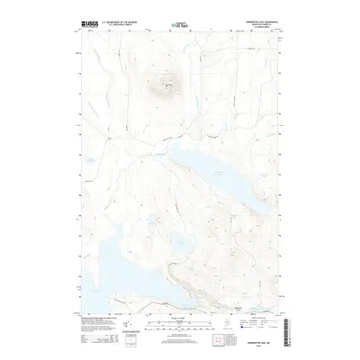
2014 Map of Harrington Lake
USGS Topo · Published 2014About this map
Soubunge Mtn rises as a prominent landmark in this northern Maine landscape, overseeing a complex network of waterways and timber roads. The southern portion of the map is dominated by the expansive Chesuncook Lake and Ripogenus Lake, which are connected by the dramatic Ripogenus Gorge along the West Branch Penobscot River. This area is defined by its industrial logging heritage, evidenced by the presence of the Golden Rd and other significant thoroughfares like Telos Rd and Frost Pond Rd. The terrain is punctuated by numerous remote water bodies, including Harrington Lake, Frost Pond, and Jackson Pond, reflecting a region shaped by natural drainage patterns and commercial forestry access.
Find a feature on this map
27 named features on this map. Tap any name to fly to it.
Don’t see what you’re looking for? This feature index may not catch every label — zoom into the map to look around manually.
Map Details
Editions of this 2014 Harrington Lake Map
This is the sole edition of this map. No revisions or reprints were ever made.
Other maps of this area

1953 · Telos Lake
USGS Topo · 1:62,500

1954 · Chesuncook
USGS Topo · 1:62,500

1954 · Grant Farm
USGS Topo · 1:62,500

1954 · Harrington Lake
USGS Topo · 1:62,500

1954 · Presque Isle
USGS Topo · 1:250,000

1954 · Millinocket
USGS Topo · 1:250,000

1957 · Telos Lake
USGS Topo · 1:62,500

1958 · Presque Isle
USGS Topo · 1:250,000

1958 · Millinocket
USGS Topo · 1:250,000

1958 · Chesuncook
USGS Topo · 1:62,500