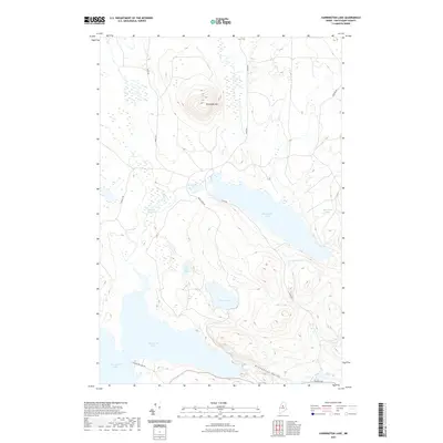
2021 Map of Harrington Lake
USGS Topo · Published 2021About this map
Soubunge Mtn dominates the northern landscape of this Piscataquis County wilderness, rising above a complex network of glacial ponds and logging roads. To the south, the massive Ripogenus Lake and Chesuncook Lake converge near the Ripogenus Gorge, a narrow passage where the West Branch of the Penobscot River flows toward Big Eddy. The map reveals a land defined by water management and timber access, with historical corridors like Telos Rd and Golden Rd providing critical infrastructure through the forest.
Find a feature on this map
19 named features on this map. Tap any name to fly to it.
Don’t see what you’re looking for? This feature index may not catch every label — zoom into the map to look around manually.
Map Details
Editions of this 2021 Harrington Lake Map
This is the sole edition of this map. No revisions or reprints were ever made.
Other maps of this area

1953 · Telos Lake
USGS Topo · 1:62,500

1954 · Chesuncook
USGS Topo · 1:62,500

1954 · Grant Farm
USGS Topo · 1:62,500

1954 · Harrington Lake
USGS Topo · 1:62,500

1954 · Presque Isle
USGS Topo · 1:250,000

1954 · Millinocket
USGS Topo · 1:250,000

1957 · Telos Lake
USGS Topo · 1:62,500

1958 · Presque Isle
USGS Topo · 1:250,000

1958 · Millinocket
USGS Topo · 1:250,000

1958 · Chesuncook
USGS Topo · 1:62,500