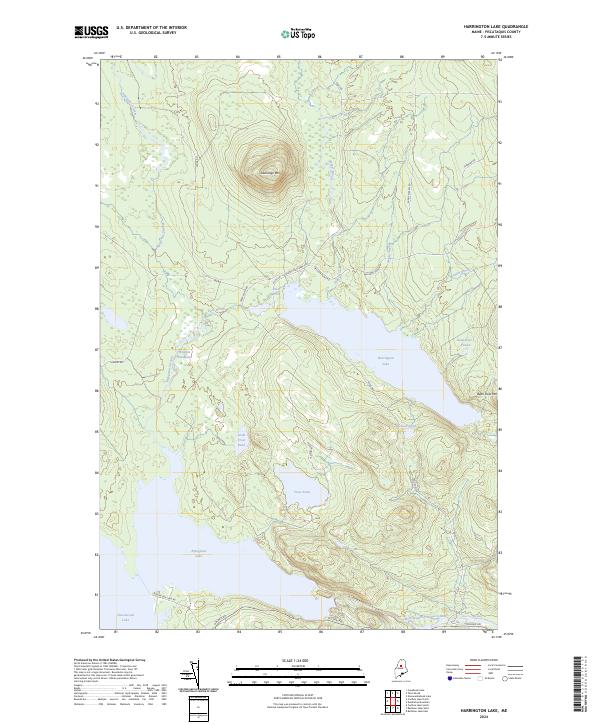
2024 Map of Harrington Lake
USGS Topo · Published 2024About this map
Harrington Lake serves as the central focal point of this wilderness quadrangle in the North Maine Woods, situated just west of the Baxter State Park Rd. The landscape is defined by its complex hydrography, where the West Branch Penobscot River flows through the dramatic Ripogenus Gorge below the massive basins of Ripogenus Lake and the northern edge of Chesuncook Lake.
Find a feature on this map
29 named features on this map. Tap any name to fly to it.
Don’t see what you’re looking for? This feature index may not catch every label — zoom into the map to look around manually.
Map Details
Editions of this 2024 Harrington Lake Map
This is the sole edition of this map. No revisions or reprints were ever made.
Other maps of this area

1953 · Telos Lake
USGS Topo · 1:62,500

1954 · Chesuncook
USGS Topo · 1:62,500

1954 · Grant Farm
USGS Topo · 1:62,500

1954 · Harrington Lake
USGS Topo · 1:62,500

1954 · Presque Isle
USGS Topo · 1:250,000

1954 · Millinocket
USGS Topo · 1:250,000

1957 · Telos Lake
USGS Topo · 1:62,500

1958 · Presque Isle
USGS Topo · 1:250,000

1958 · Millinocket
USGS Topo · 1:250,000

1958 · Chesuncook
USGS Topo · 1:62,500