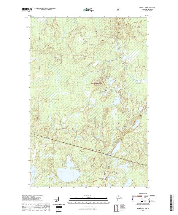
2022 Map of Harris Lake
USGS Topo · Published 2022About this map
Ottawa National Forest dominates the northern reaches of this landscape, where the Presque Isle Wild and Scenic River and its western branch carve through a dense network of glacial water bodies. The geography is defined by an intricate system of forest roads and trails, such as Nfst-8183 Trl and Fisher Rd, which provide access to a wilderness of interconnected lakes and creeks. In the southern portion, Harris Lake stands as a primary landmark near the Wisconsin-Michigan state line, fed by Harris Creek and surrounded by smaller basins like Nell Lake and Genevieve Lake. The naming conventions throughout the area, including Twin Pups Lakes, Osprey Lake, and Foxpaw Lake, reflect a landscape deeply tied to regional wildlife and natural features. This survey illustrates the protected character of the Northwoods, emphasizing the conservation of the watershed and the accessibility of its remote waterways via the Canoe W Branch Presque Isle Trl.
Find a feature on this map
108 named features on this map. Tap any name to fly to it.
Don’t see what you’re looking for? This feature index may not catch every label — zoom into the map to look around manually.
Map Details
Editions of this 2022 Harris Lake Map
This is the sole edition of this map. No revisions or reprints were ever made.
Other maps of this area

1939 · Trout Lake
USGS Topo · 1:48,000

1939 · Winchester
USGS Topo · 1:48,000

1946 · Winchester
USGS Topo · 1:48,000

1946 · Trout Lake
USGS Topo · 1:48,000

1949 · Trout Lake
USGS Topo · 1:48,000

1955 · Marenisco
USGS Topo · 1:62,500

1955 · Boulder Junction
USGS Topo · 1:62,500

1955 · Winchester
USGS Topo · 1:62,500

1955 · Marenisco
USGS Topo · 1:24,000

1955 · Wakefield
USGS Topo · 1:24,000