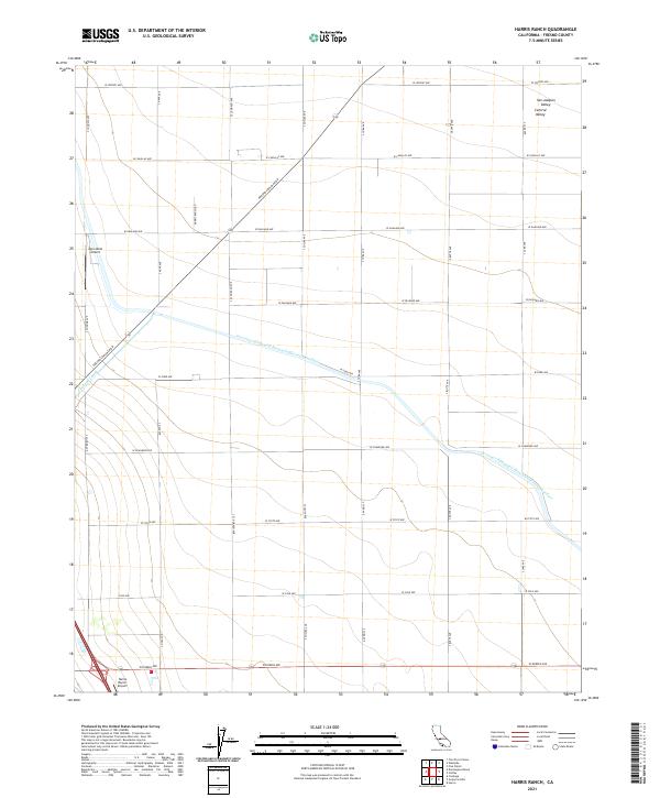
2021 Map of Harris Ranch
USGS Topo · Published 2021About this map
The Governor Edmund G Brown California Aqueduct and the Coalinga Canal dominate the hydrology of this Central Valley landscape, illustrating the massive scale of industrial water management in the San Joaquin Valley. The map shows a precise grid of rural roads, including Fresno Coalinga Rd and Harris Ranch Rd, which serve a highly organized agricultural region. Aviation infrastructure is central to operations here, with both the Agro-West Airport and the Harris Ranch Airport situated among the expansive fields. The township and range boundaries, such as t18s r16e and t19s r17e, provide the underlying legal framework for this productive landscape, where the intersection of water rights and modern transport defines the local economy.
Find a feature on this map
28 named features on this map. Tap any name to fly to it.
Don’t see what you’re looking for? This feature index may not catch every label — zoom into the map to look around manually.
Map Details
Editions of this 2021 Harris Ranch Map
This is the sole edition of this map. No revisions or reprints were ever made.
Other maps of this area

1912 · Coalinga
USGS Topo · 1:125,000

1928 · Delta Farms No 3
USGS Topo · 1:31,680

1931 · Wheatville
USGS Topo · 1:31,680

1931 · Towne Oil Station
USGS Topo · 1:31,680

1931 · Mouth of Cantua Creek
USGS Topo · 1:31,680

1932 · Delta Farms
USGS Topo · 1:31,680

1932 · West of Lethent
USGS Topo · 1:31,680

1933 · Huron
USGS Topo · 1:31,680

1933 · Guijarral Hills
USGS Topo · 1:31,680
1936 · Guijarral Hills
USGS Topo · 1:31,680