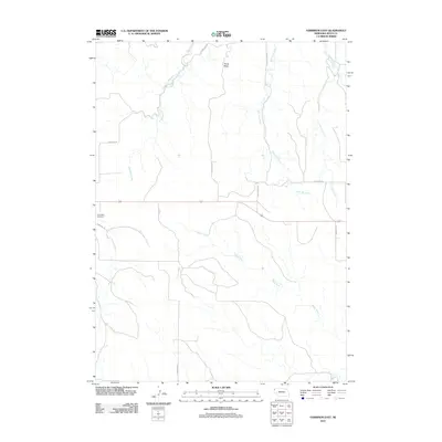
2011 Map of Harrison East
USGS Topo · Published 2011About this map
The White River and its numerous tributaries define the drainage of this Sioux County landscape, carving through the high plains near the Wyoming border. This 2011 survey captures the area's rural road network, which follows the natural contours of the land, including routes like Sowbelly Rd and W Hat Creek Rd. The presence of Saint Mary Cemetery on Cemetery Rd offers a point of interest for genealogists tracing local family histories in this sparsely populated region. To the north, the terrain is marked by distinctive elevations such as Pants Butte, situated near the headwaters of West Hat Creek. This map illustrates the intersection of geography and local travel, where long-established dirt and gravel roads connect remote ranchlands and natural landmarks like Soubelly Creek and East Hat Creek.
Find a feature on this map
14 named features on this map. Tap any name to fly to it.
Don’t see what you’re looking for? This feature index may not catch every label — zoom into the map to look around manually.
Map Details
Editions of this 2011 Harrison East Map
This is the sole edition of this map. No revisions or reprints were ever made.
Other maps of this area

1955 · Alliance
USGS Topo · 1:250,000

1957 · Alliance
USGS Topo · 1:250,000

1958 · Alliance
USGS Topo · 1:250,000

1978 · Harrison West
USGS Topo · 1:24,000

1979 · Harrison SE
USGS Topo · 1:24,000
1979 · Harrison SW
USGS Topo · 1:24,000

1979 · Harrison East
USGS Topo · 1:24,000

1980 · Kyle Creek
USGS Topo · 1:24,000

1980 · Five Points
USGS Topo · 1:24,000

1980 · Andrews
USGS Topo · 1:24,000