Old Maps of Harrison, Bowen Precinct
Explore 14 old maps of Harrison, spanning from 1955 to today. These high-resolution historic maps reveal how streets, neighborhoods, landmarks, and natural features evolved over time — perfect for genealogy, metal detecting, research, and local history exploration.
What you can do with these maps:
- See how Harrison changed over time: Compare historical maps to modern-day views to trace roads, homesites, rail lines & more.
- View detailed metadata: Each map includes creators, publishers, year, scale, and archive source.
- Overlay maps with satellite & LiDAR: Visualize the past alongside modern tools to explore terrain & human change.
- Trusted historical sources: Maps sourced from the USGS, Library of Congress, and other archives.
- Access maps your way: View online, download high-res files, or order prints for personal or research use.
Start exploring old maps of Harrison to uncover forgotten places, hidden landmarks, and the deep history beneath your feet.
Harrison, Bowen Precinct maps
(14)- 1955 Map of Alliance, 1966 Print
 1955 Alliance1966 Print · USGSThe Nebraska panhandle comes into sharp focus during the mid-fifties, showing a landscape defined by the Niobrara River and the expanding Sand Hills. Researchers can trace the grounds of Fort Robinson, locate Saint Marys Church, or follow the Chicago Burlington and Quincy rail line through Hemingford.3 unique versions available
 - 1957 Map of Alliance
 1957 Alliance1957 Print · USGSNorthwest Nebraska in the mid-fifties is captured here as a landscape of rail hubs, sprawling cattle ranches, and the eastern edge of the dunes. Genealogists and historians can trace rail lines through Alliance and Chadron or locate landmarks like Saint Marys Church and the Agate Spring Fossil Beds.
 - 1958 Map of Alliance
 1958 Alliance1958 Print · USGSNorthwestern Nebraska in the late fifties shows a landscape shaped by the legacy of the high plains frontier and modern agricultural expansion. Genealogists and historians can trace rail-line settlements and landmarks like Fort Robinson and the Agate Spring Fossil Beds.
 - 1978 Map of Harrison West, 1979 Print
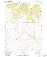
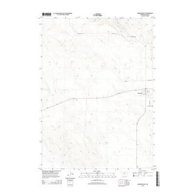
 1978 Harrison West1979 Print · USGSSioux County life in the late 1970s centers on the railroad crossroads of Harrison and the surrounding High Plains. Researchers can trace the Chicago and North Western line, locate the Cem, and see the layout of the County Fairground.
 - 1979 Map of Harrison East, 1988 Print
 1979 Harrison East1988 Print · USGSNear the high Nebraska border in the late seventies, this survey captures a vital rail and ranching landscape. Genealogists and local historians can trace the foundations of Harrison and locate family names at Harrison Cem or St Mary Cem along the Chicago and North Western line.
 - 1986 Map of Crawford
 1986 Crawford1986 Print · USGSThe Nebraska Panhandle in the mid-eighties shows a high-plains landscape defined by its rugged geology and major rail corridors. Genealogists and historians can trace the paths of the Burlington Northern railroad through settlements like Orella, Glen, and Harrison.2 unique versions available
 - 2011 Map of Harrison West, 2011 Print
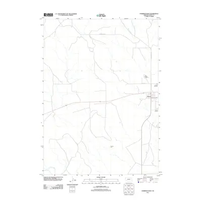 2011 Harrison West2011 Print · USGSCovers Harrison, including Bowen Precinct, Sioux County, and other nearby areas
 - 2011 Map of Harrison East, 2011 Print
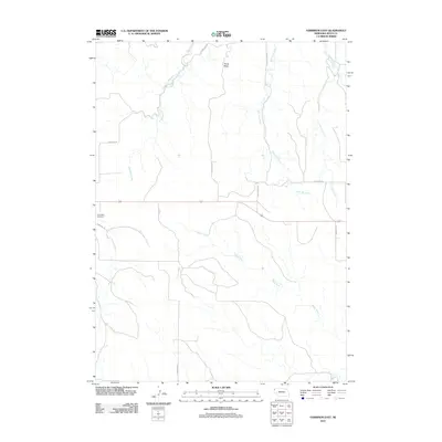 2011 Harrison East2011 Print · USGSCovers Harrison, including Bowen Precinct, Sioux County, and other nearby areas
 - 2014 Map of Harrison West, 2014 Print
 2014 Harrison West2014 Print · USGSCovers Harrison, including Bowen Precinct, Sioux County, and other nearby areas
 - 2014 Map of Harrison East, 2014 Print
 2014 Harrison East2014 Print · USGSCovers Harrison, including Bowen Precinct, Sioux County, and other nearby areas
 - 2017 Map of Harrison East, 2017 Print
 2017 Harrison East2017 Print · USGSCovers Harrison, including Bowen Precinct, Sioux County, and other nearby areas
 - 2017 Map of Harrison West, 2017 Print
 2017 Harrison West2017 Print · USGSCovers Harrison, including Bowen Precinct, Sioux County, and other nearby areas
 - 2021 Map of Harrison East, 2021 Print
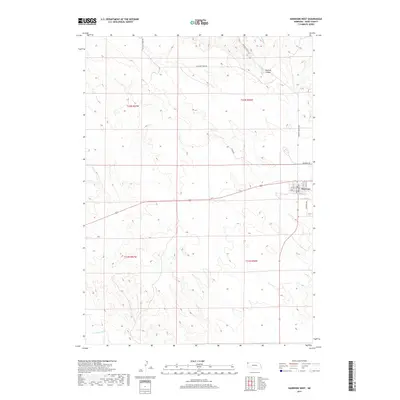
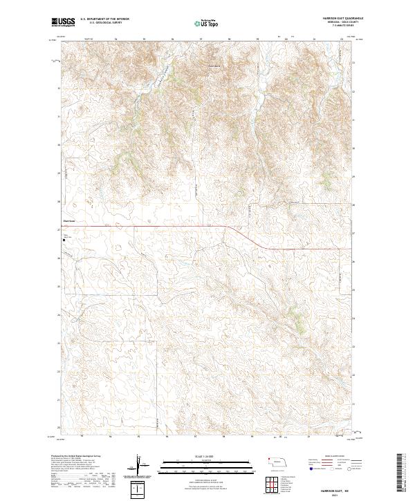 2021 Harrison East2021 Print · USGSHarrison and the high ranching country of Sioux County are captured here in the modern era. Genealogists and local historians can trace the roads and drainages of the Pine Ridge, from Saint Mary Cem to the depths of Sowbelly Canyon.
 - 2021 Map of Harrison West, 2021 Print
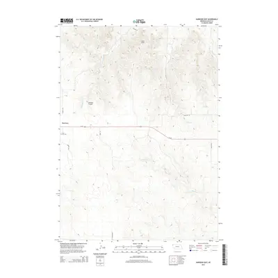
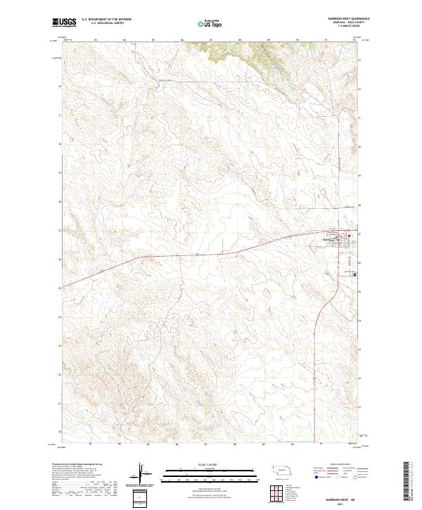 2021 Harrison West2021 Print · USGSHarrison remains the center of life in Sioux County in the early twenty-first century, anchored by its civic and community landmarks. Researchers can trace local history from the Sioux County Courthouse to the Harrison Cem and the winding Monroe Canyon Rd.
End of results
Showing maps 1-14 of 14
Top cities near Harrison
Frequently asked questions
- What are the different types of historical maps available for Harrison?
- What is the oldest map of Harrison?
- Where can I purchase historical maps of Harrison for my home or office?
- Where can I download high-res historical maps of Harrison?
- Are there historical topographic maps available for Harrison?
- Is there historical aerial imagery available for Harrison?
- Where are historical maps of Harrison sourced from?