
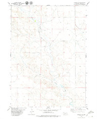
1978 Map of Harrison West
USGS Topo · Published 1979About this map
Harrison serves as the focal point of this Sioux County landscape, situated at the junction of the Chicago and North Western railroad and local thoroughfares. This high-plains region in the late 1970s shows a clear transition from the structured street grid of the town to the expansive rangeland surrounding it. Notable civic and local landmarks include the County Fairground and Skyranch Airport on the eastern edge of the settlement, while the Cem south of town provides a point of interest for genealogical research. To the north, the terrain grows more complex around Monroe Canyon and the Gilbert Baker State Wildlife Management Area, offering a contrast to the flatter sections near the Niobrara River in the south. Smaller, more isolated points like Tipton indicate the dispersed nature of settlement in this part of western Nebraska.
Find a feature on this map
10 named features on this map. Tap any name to fly to it.
Don’t see what you’re looking for? This feature index may not catch every label — zoom into the map to look around manually.
Map Details
Editions of this 1978 Harrison West Map
This is the sole edition of this map. No revisions or reprints were ever made.
Other maps of this area

1954 · Torrington
USGS Topo · 1:250,000

1955 · Alliance
USGS Topo · 1:250,000

1957 · Alliance
USGS Topo · 1:250,000

1958 · Torrington
USGS Topo · 1:250,000

1958 · Alliance
USGS Topo · 1:250,000

1977 · Van Tassell
USGS Topo · 1:24,000

1977 · Van Tassell SE
USGS Topo · 1:24,000

1978 · Kirtley
USGS Topo · 1:24,000

1979 · Harrison SE
USGS Topo · 1:24,000
1979 · Harrison SW
USGS Topo · 1:24,000