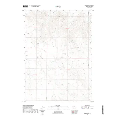
2017 Map of Harrison East
USGS Topo · Published 2017About this map
Harrison stands as a focal point in this northwestern Nebraska landscape, where the High Plains transition into the distinctive breaks of the Pine Ridge. The topography is defined by the carved features of Sowbelly Canyon and the prominent rising form of Pants Butte to the north. These geological formations dictate the drainage patterns of the region, feeding various waterways including Sowbelly Cr, W Hat Cr, and the White River as they cut through the dry terrain.
Find a feature on this map
23 named features on this map. Tap any name to fly to it.
Don’t see what you’re looking for? This feature index may not catch every label — zoom into the map to look around manually.
Map Details
Editions of this 2017 Harrison East Map
This is the sole edition of this map. No revisions or reprints were ever made.
Other maps of this area

1955 · Alliance
USGS Topo · 1:250,000

1957 · Alliance
USGS Topo · 1:250,000

1958 · Alliance
USGS Topo · 1:250,000

1978 · Harrison West
USGS Topo · 1:24,000

1979 · Harrison SE
USGS Topo · 1:24,000
1979 · Harrison SW
USGS Topo · 1:24,000

1979 · Harrison East
USGS Topo · 1:24,000

1980 · Kyle Creek
USGS Topo · 1:24,000

1980 · Five Points
USGS Topo · 1:24,000

1980 · Andrews
USGS Topo · 1:24,000