
1979 Map of Harrison East
USGS Topo · Published 1988About this map
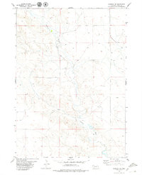
The high plains of Sioux County meet the headwaters of the White River in this detailed survey of the Nebraska panhandle. The village of Harrison serves as the regional anchor, situated at a vital transportation junction where the Chicago and North Western railroad corridor cuts across the landscape. Local history and genealogy are well-represented by the inclusion of St Mary Cem and Harrison Cem, while the northern terrain is defined by dramatic geological features like Pants Butte and the winding Sowbelly canyon. The presence of Skyranch Airport and numerous water points, including West Hat Creek and East Hat Creek, illustrates the balance between modern aviation and the essential livestock ranching economy that sustains this corner of Nebraska.
Find a feature on this map
15 named features on this map. Tap any name to fly to it.
Don’t see what you’re looking for? This feature index may not catch every label — zoom into the map to look around manually.
Map Details
Editions of this 1979 Harrison East Map
This is the sole edition of this map. No revisions or reprints were ever made.
Other maps of this area

1955 · Alliance
USGS Topo · 1:250,000

1957 · Alliance
USGS Topo · 1:250,000

1958 · Alliance
USGS Topo · 1:250,000

1978 · Harrison West
USGS Topo · 1:24,000

1979 · Harrison SE
USGS Topo · 1:24,000
1979 · Harrison SW
USGS Topo · 1:24,000

1980 · Kyle Creek
USGS Topo · 1:24,000

1980 · Five Points
USGS Topo · 1:24,000

1980 · Andrews
USGS Topo · 1:24,000
1980 · Warbonnet Ranch
USGS Topo · 1:24,000