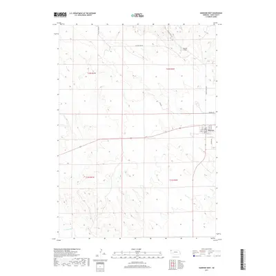
2017 Map of Harrison West
USGS Topo · Published 2017About this map
The village of Harrison serves as the focal point of this Western Nebraska landscape, situated near the headwaters of the Niobrara River. As the county seat of Sioux County, the town's grid is clearly defined by streets such as Main St, Rose St, and Grace St, representing a settled hub in a largely open agricultural and ranching region. To the north, the terrain becomes more varied as it descends into Monroe Canyon, where the drainage of E Monroe Cr begins. This transition from the high plains to the canyon country is reflected in the winding path of Monroe Canyon Rd. Local history is anchored by rural landmarks like Cemetery Rd and the throughways of Pleasant Ridge Rd and Sowbelly Rd, which navigate the township lines of t32n r57w and t31n r56w.
Find a feature on this map
19 named features on this map. Tap any name to fly to it.
Don’t see what you’re looking for? This feature index may not catch every label — zoom into the map to look around manually.
Map Details
Editions of this 2017 Harrison West Map
This is the sole edition of this map. No revisions or reprints were ever made.
Other maps of this area

1954 · Torrington
USGS Topo · 1:250,000

1955 · Alliance
USGS Topo · 1:250,000

1957 · Alliance
USGS Topo · 1:250,000

1958 · Torrington
USGS Topo · 1:250,000

1958 · Alliance
USGS Topo · 1:250,000

1977 · Van Tassell
USGS Topo · 1:24,000

1977 · Van Tassell SE
USGS Topo · 1:24,000

1978 · Harrison West
USGS Topo · 1:24,000

1978 · Kirtley
USGS Topo · 1:24,000

1979 · Harrison SE
USGS Topo · 1:24,000