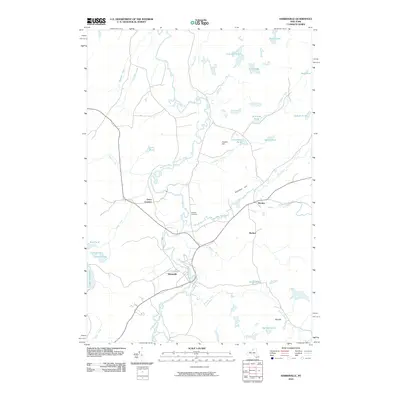
2010 Map of Harrisville
USGS Topo · Published 2010About this map
The West Branch Oswegatchie River meanders across this northern New York landscape, anchoring the settlement of Harrisville where the river turns sharply south. This 2010 topographic record captures the intersection of small upland hamlets and a dense network of water bodies, including the northeastern edge of Lake Bonaparte. To the north, the terrain rises toward Cooper Hill and Baldface Hill, while the valley floor is punctuated by small clusters of activity at Geers Corners and Pitcairn. Family history and local heritage are preserved at the Garrison Cemetery, situated near the confluence of Big Creek and the main river branch. The map reveals a transition between concentrated village life and the numerous glacial ponds and marshes, such as Shiner Pond and Goose Pond, that characterize the region's complex drainage pattern.
Find a feature on this map
34 named features on this map. Tap any name to fly to it.
Don’t see what you’re looking for? This feature index may not catch every label — zoom into the map to look around manually.
Map Details
Editions of this 2010 Harrisville Map
This is the sole edition of this map. No revisions or reprints were ever made.
Other maps of this area

1913 · Lake Bonaparte
USGS Topo · 1:62,500

1915 · Gouverneur
USGS Topo · 1:62,500

1915 · Russell
USGS Topo · 1:62,500

1916 · Lake Bonaparte
USGS Topo · 1:62,500

1916 · Oswegatchie
USGS Topo · 1:62,500

1918 · Russell
USGS Topo · 1:62,500

1918 · Oswegatchie
USGS Topo · 1:62,500

1937 · Gouverneur
USGS Topo · 1:62,500

1948 · Ogdensburg
USGS Topo · 1:250,000

1951 · Ogdensburg
USGS Topo · 1:250,000