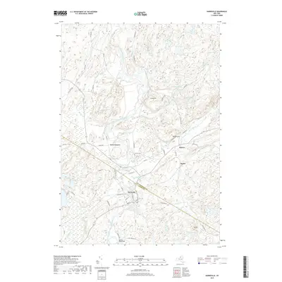
2019 Map of Harrisville
USGS Topo · Published 2019About this map
The West Branch Oswegatchie River winds through this northern New York landscape, carving a path between St. Lawrence Co and Lewis Co. The settlement of Harrisville serves as a primary hub, with its grid of Main St, Church St, and Railroad St indicating a localized center of commerce and community. Small hamlets and named intersections like Geers Corners, Pitcairn, and Backus are connected by a network of county roads, such as Co Rd 26 and Co Rd 7, which navigate the various ponds and streams that define the region.
Find a feature on this map
68 named features on this map. Tap any name to fly to it.
Don’t see what you’re looking for? This feature index may not catch every label — zoom into the map to look around manually.
Map Details
Editions of this 2019 Harrisville Map
This is the sole edition of this map. No revisions or reprints were ever made.
Other maps of this area

1913 · Lake Bonaparte
USGS Topo · 1:62,500

1915 · Gouverneur
USGS Topo · 1:62,500

1915 · Russell
USGS Topo · 1:62,500

1916 · Lake Bonaparte
USGS Topo · 1:62,500

1916 · Oswegatchie
USGS Topo · 1:62,500

1918 · Russell
USGS Topo · 1:62,500

1918 · Oswegatchie
USGS Topo · 1:62,500

1937 · Gouverneur
USGS Topo · 1:62,500

1948 · Ogdensburg
USGS Topo · 1:250,000

1951 · Ogdensburg
USGS Topo · 1:250,000