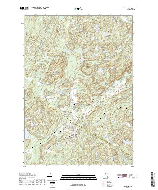
2023 Map of Harrisville
USGS Topo · Published 2023About this map
Harrisville serves as the primary hub of this northern New York landscape, situated where the West Branch Oswegatchie River winds through the border of St. Lawrence and Lewis counties. The settlement pattern follows old transit corridors, with Geers Corners and Pitcairn marking historical crossroads north of the river. A dense network of water bodies, including Beaver Lake, Twin Ponds, and Toothaker Pond, defines the terrain between prominent rises like Baldface Hill and Cooper Hill. Genealogists may find particular interest in the Garrison Cem located near Big Creek. The presence of named tracks such as Railroad St and Ore Bed Rd points to the region's industrial past, while the numerous ponds and creeks suggest a landscape historically shaped by timber and water power.
Find a feature on this map
69 named features on this map. Tap any name to fly to it.
Don’t see what you’re looking for? This feature index may not catch every label — zoom into the map to look around manually.
Map Details
Editions of this 2023 Harrisville Map
This is the sole edition of this map. No revisions or reprints were ever made.
Other maps of this area

1913 · Lake Bonaparte
USGS Topo · 1:62,500

1915 · Gouverneur
USGS Topo · 1:62,500

1915 · Russell
USGS Topo · 1:62,500

1916 · Lake Bonaparte
USGS Topo · 1:62,500

1916 · Oswegatchie
USGS Topo · 1:62,500

1918 · Russell
USGS Topo · 1:62,500

1918 · Oswegatchie
USGS Topo · 1:62,500

1937 · Gouverneur
USGS Topo · 1:62,500

1948 · Ogdensburg
USGS Topo · 1:250,000

1951 · Ogdensburg
USGS Topo · 1:250,000