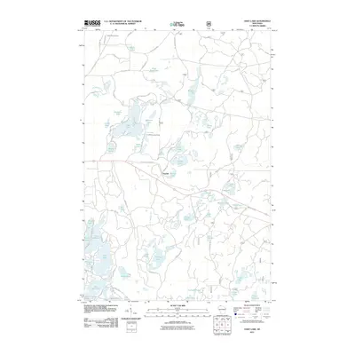
2011 Map of Hart Lake
USGS Topo · Published 2011About this map
Glacial kettle lakes and recreational waterways dominate this portion of Bayfield County, where the sprawling Tri-County Corridor cuts a straight path across the central landscape. The small settlement of Topside serves as a local landmark near Topside Lake and Wentzel Lake, while the Iron River Lookout Tower stands as a reminder of the region's forestry management history. The map detail reveals a dense network of local routes like Battle Axe Rd and Town Road 18, which provide access to family-named water bodies such as Steckbaur Lake and McCarry Lake. To the north, Valley View Cemetery marks a point of local genealogy, overlooking the headwaters of DeChamps Creek. The area’s complex hydrology is evident in the cluster of southern basins, including Lake Nokomis and the intricately shaped Five Island Lake.
Find a feature on this map
83 named features on this map. Tap any name to fly to it.
Don’t see what you’re looking for? This feature index may not catch every label — zoom into the map to look around manually.
Map Details
Editions of this 2011 Hart Lake Map
This is the sole edition of this map. No revisions or reprints were ever made.
Other maps of this area

1943 · Iron Lake
USGS Topo · 1:48,000

1944 · Moquah
USGS Topo · 1:48,000

1944 · Drummond
USGS Topo · 1:48,000

1944 · Grandview
USGS Topo · 1:48,000

1947 · Drummond
USGS Topo · 1:48,000

1947 · Moquah
USGS Topo · 1:48,000

1947 · Iron Lake
USGS Topo · 1:48,000

1947 · Grandview
USGS Topo · 1:48,000

1953 · Ashland
USGS Topo · 1:250,000

1958 · Ashland
USGS Topo · 1:250,000