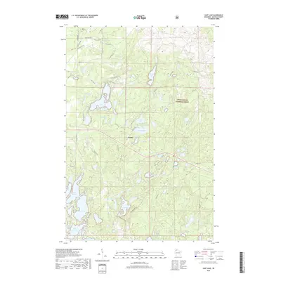
2018 Map of Hart Lake
USGS Topo · Published 2018About this map
Chequamegon National Forest defines the character of this northern Wisconsin landscape, where the dense concentration of glacial lakes shapes the local geography and road network. The small settlement of Topside serves as a central point between several major water bodies, including Topside Lake, Wentzel Lake, and the larger Loon Lake. Local roads such as Battleax Grade and Tripp Gravel Pit Rd cut through the timberland, reflecting the region's historic ties to the logging industry and resource extraction. In the northern section, Valley View Cem stands near Bailey Lake, providing a clear focal point for genealogical research. The southern portion is dominated by interconnected basins like Hart Lake, Lake Millicent, and Crooked Lake, illustrating the complex hydrology of Bayfield County’s lake country.
Find a feature on this map
68 named features on this map. Tap any name to fly to it.
Don’t see what you’re looking for? This feature index may not catch every label — zoom into the map to look around manually.
Map Details
Editions of this 2018 Hart Lake Map
This is the sole edition of this map. No revisions or reprints were ever made.
Other maps of this area

1943 · Iron Lake
USGS Topo · 1:48,000

1944 · Moquah
USGS Topo · 1:48,000

1944 · Drummond
USGS Topo · 1:48,000

1944 · Grandview
USGS Topo · 1:48,000

1947 · Drummond
USGS Topo · 1:48,000

1947 · Moquah
USGS Topo · 1:48,000

1947 · Iron Lake
USGS Topo · 1:48,000

1947 · Grandview
USGS Topo · 1:48,000

1953 · Ashland
USGS Topo · 1:250,000

1958 · Ashland
USGS Topo · 1:250,000