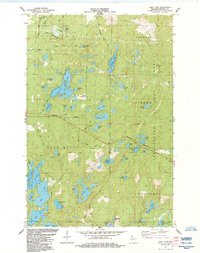
1984 Map of Hart Lake
USGS Topo · Published 1984About this map
Chequamegon National Forest encompasses much of this Wisconsin landscape, where glacial kettles and moraines have created an intricate network of waterways. The Burlington Northern railroad corridor cuts across the central terrain, passing through the townships of Pilsen and Iron River. Significant water bodies like Long Lake, Island Lake, and Hart Lake are surrounded by a dense web of local roads, including Battleax Road and Lavin Road. Local history is anchored by the Valley View Cem in the northwest and the Iron River Lookout Tower, which served as a vital observation point for forest management. Recreational sites such as the Wanoka Lake Campground and Wayside Park reflect the area's transition into a destination for outdoorsmen and travelers in the mid-1980s.
Find a feature on this map
58 named features on this map. Tap any name to fly to it.
Don’t see what you’re looking for? This feature index may not catch every label — zoom into the map to look around manually.
Map Details
Editions of this 1984 Hart Lake Map
This is the sole edition of this map. No revisions or reprints were ever made.
Other maps of this area

1943 · Iron Lake
USGS Topo · 1:48,000

1944 · Moquah
USGS Topo · 1:48,000

1944 · Drummond
USGS Topo · 1:48,000

1944 · Grandview
USGS Topo · 1:48,000

1947 · Drummond
USGS Topo · 1:48,000

1947 · Moquah
USGS Topo · 1:48,000

1947 · Iron Lake
USGS Topo · 1:48,000

1947 · Grandview
USGS Topo · 1:48,000

1953 · Ashland
USGS Topo · 1:250,000

1958 · Ashland
USGS Topo · 1:250,000