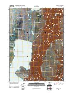
2011 Map of Hart Lake
USGS Topo · Published 2011About this map
Hart Lake and its associated wetlands dominate this arid high-desert landscape in Oregon's Lake County. The map documents a fragile water system where Givens Slough and Honey Creek feed into the lake, while northern reaches connect Vinyard Lake and Anderson Lake. Evidence of human settlement is tied closely to these water sources and canyon floors, represented by legacy landholdings such as Laird Ranch and the D Fitzgerald Ranch. To the east, the terrain rises sharply toward Hart Mountain, a massive fault block that looms over the Alkali Flat. This survey illustrates the intricate drainage patterns of the Great Basin, where seasonal flows carved the Arsenic Canyon and De Garmo Canyon into the high plateau, creating isolated pockets suitable for ranching along County Hwy 3-12.
Find a feature on this map
22 named features on this map. Tap any name to fly to it.
Don’t see what you’re looking for? This feature index may not catch every label — zoom into the map to look around manually.
Map Details
Editions of this 2011 Hart Lake Map
This is the sole edition of this map. No revisions or reprints were ever made.
Other maps of this area

1955 · Adel
USGS Topo · 1:250,000

1957 · Adel
USGS Topo · 1:250,000

1958 · Adel
USGS Topo · 1:250,000

1962 · Adel
USGS Topo · 1:250,000

1967 · Flagstaff Lake
USGS Topo · 1:24,000

1967 · Jacobs Reservoir
USGS Topo · 1:24,000

1967 · Plush
USGS Topo · 1:24,000

1967 · Rabbit Hills SW
USGS Topo · 1:24,000

1967 · Priday Reservoir
USGS Topo · 1:24,000

1967 · Campbell Lake
USGS Topo · 1:24,000