
1967 Map of Jacobs Reservoir
USGS Topo · Published 1969About this map
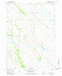
Hart Mountain National Antelope Refuge dominates this high-desert landscape in Lake County, defining a region where water management and wildlife conservation intersect. The terrain is characterized by a series of shallow lakes and depressions, including Mound Lake, Long Lake, and Jack Lake, which dot the arid plateau. Central to the area's hydrology is Jacobs Reservoir, fed by Guano Creek. A network of Jeep Trails provides the primary means of traversal through features like Clover Swale and Riffle Canyon. The map records a specific moment in the mid-1960s when the region's scattered water bodies, such as School Section Lake and Robinson Lake, served as vital landmarks for navigation and land use within the refuge's boundaries.
Find a feature on this map
24 named features on this map. Tap any name to fly to it.
Don’t see what you’re looking for? This feature index may not catch every label — zoom into the map to look around manually.
Map Details
Editions of this 1967 Jacobs Reservoir Map
2 editions found
Other maps of this area

1955 · Adel
USGS Topo · 1:250,000

1957 · Adel
USGS Topo · 1:250,000

1958 · Adel
USGS Topo · 1:250,000

1962 · Adel
USGS Topo · 1:250,000

1967 · Alger Lake
USGS Topo · 1:24,000

1967 · Hart Lake
USGS Topo · 1:24,000

1967 · Warner Peak
USGS Topo · 1:24,000

1967 · Swede Knoll
USGS Topo · 1:24,000

1967 · Crump Lake
USGS Topo · 1:24,000

1968 · Guano Lake
USGS Topo · 1:24,000