
1967 Map of Alger Lake
USGS Topo · Published 1969About this map
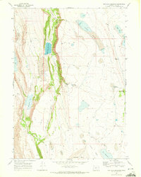
Hart Mountain National Antelope Refuge dominates this high-desert landscape in southeastern Oregon, as recorded during the late 1960s. The map captures a complex system of seasonal water bodies and terminal basins, including the expansive Alger Lake and smaller catchments like Fred Pond and Dobbins Lake. These water sources were critical for both the native antelope populations and historical ranching activities, evidenced by features such as the Coffee Pot Reservoir and Hitching Post Water Hole. To the south, the topography drops into the Guano Valley where Guano Creek flows, while the high plateau of Hart Mountain provides a dramatic backdrop. A network of Jeep Trails connects these remote points, following natural features like Clover Swale and providing access to family-named landmarks such as Billy Burr Lake.
Find a feature on this map
19 named features on this map. Tap any name to fly to it.
Don’t see what you’re looking for? This feature index may not catch every label — zoom into the map to look around manually.
Map Details
Editions of this 1967 Alger Lake Map
This is the sole edition of this map. No revisions or reprints were ever made.
Other maps of this area

1955 · Adel
USGS Topo · 1:250,000

1957 · Adel
USGS Topo · 1:250,000

1958 · Adel
USGS Topo · 1:250,000

1962 · Adel
USGS Topo · 1:250,000

1967 · Jacobs Reservoir
USGS Topo · 1:24,000

1967 · Warner Peak
USGS Topo · 1:24,000

1967 · Swede Knoll
USGS Topo · 1:24,000

1968 · Guano Lake
USGS Topo · 1:24,000
1968 · Mud Lake Reservoir
USGS Topo · 1:24,000
1971 · Beatys Butte NW
USGS Topo · 1:24,000