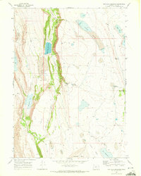
1968 Map of Mud Lake Reservoir
USGS Topo · Published 1972About this map
Mud Lake Reservoir sits at the heart of this high desert landscape in Lake County, where water management defines the arid terrain. The 1968 field survey reveals a system of catchments and natural basins, including the expansive Long Lake and smaller, specifically named water sources like Heads Waterhole and Barry Spring. The topography is dominated by the steep ascent of Fisher Canyon and the prominent Little Juniper Mtn to the east, illustrating the stark relief of the Great Basin region.
Find a feature on this map
22 named features on this map. Tap any name to fly to it.
Don’t see what you’re looking for? This feature index may not catch every label — zoom into the map to look around manually.
Map Details
Editions of this 1968 Mud Lake Reservoir Map
2 editions found
Other maps of this area

1955 · Adel
USGS Topo · 1:250,000

1957 · Adel
USGS Topo · 1:250,000

1958 · Adel
USGS Topo · 1:250,000

1962 · Adel
USGS Topo · 1:250,000

1967 · Jacobs Reservoir
USGS Topo · 1:24,000

1967 · Alger Lake
USGS Topo · 1:24,000

1967 · Crump Lake
USGS Topo · 1:24,000
1968 · Piute Reservoir
USGS Topo · 1:24,000

1968 · Guano Lake
USGS Topo · 1:24,000
1968 · Calderwood Reservoir
USGS Topo · 1:24,000