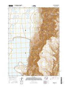
2017 Map of Hart Lake
USGS Topo · Published 2017About this map
Hart Lake dominates this high-desert basin in Lake County, serving as a focal point for a landscape defined by dramatic elevation shifts and seasonal water. To the east, the massive fault-block ridge of Hart Mtn rises sharply, its western face carved by numerous drainage systems including Arsenic Canyon, De Garmo Canyon, and Potter Canyon. These canyons channel water toward the lakebed from the higher elevations of the Great Basin range. The map illustrates a complex network of wetlands and intermittent water bodies, such as Anderson Lake, Vinyard Lake, and Givens Slough, which highlight the variable nature of the local hydrology. This 2017 survey shows the limited human footprint in the area, primarily restricted to Hart Mountain Rd as it skirts the edge of the wetlands and the steep mountain slopes.
Find a feature on this map
21 named features on this map. Tap any name to fly to it.
Don’t see what you’re looking for? This feature index may not catch every label — zoom into the map to look around manually.
Map Details
Editions of this 2017 Hart Lake Map
This is the sole edition of this map. No revisions or reprints were ever made.
Other maps of this area

1955 · Adel
USGS Topo · 1:250,000

1957 · Adel
USGS Topo · 1:250,000

1958 · Adel
USGS Topo · 1:250,000

1962 · Adel
USGS Topo · 1:250,000

1967 · Flagstaff Lake
USGS Topo · 1:24,000

1967 · Jacobs Reservoir
USGS Topo · 1:24,000

1967 · Plush
USGS Topo · 1:24,000

1967 · Rabbit Hills SW
USGS Topo · 1:24,000

1967 · Priday Reservoir
USGS Topo · 1:24,000

1967 · Campbell Lake
USGS Topo · 1:24,000