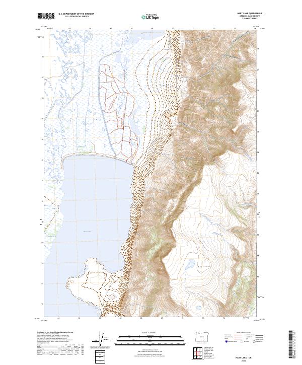
2024 Map of Hart Lake
USGS Topo · Published 2024About this map
Hart Mountain National Antelope Refuge dominates the eastern half of this landscape, where the dramatic rise of Hart Mtn meets the high desert wetlands of Lake County. This modern survey illustrates the sharp transition between the aquatic environments of the Warner Valley and the steep, complex drainage systems of the Hart Mountain massif. On the western side, the expansive Hart Lake is fed by complex water systems including Givens Slough and Anderson Lake, while the Warner Wetlands Loop Trl provides access to the marshy margins of Vinyard Lake. To the east, the terrain becomes increasingly vertical, carved by deep corridors such as Arsenic Canyon, Potter Canyon, and De Garmo Canyon. These features demonstrate the unique basin and range geography where seasonal creeks like Warner Creek and Goat Creek descend from the highlands toward the valley floor.
Find a feature on this map
25 named features on this map. Tap any name to fly to it.
Don’t see what you’re looking for? This feature index may not catch every label — zoom into the map to look around manually.
Map Details
Editions of this 2024 Hart Lake Map
This is the sole edition of this map. No revisions or reprints were ever made.
Other maps of this area

1955 · Adel
USGS Topo · 1:250,000

1957 · Adel
USGS Topo · 1:250,000

1958 · Adel
USGS Topo · 1:250,000

1962 · Adel
USGS Topo · 1:250,000

1967 · Flagstaff Lake
USGS Topo · 1:24,000

1967 · Jacobs Reservoir
USGS Topo · 1:24,000

1967 · Plush
USGS Topo · 1:24,000

1967 · Rabbit Hills SW
USGS Topo · 1:24,000

1967 · Priday Reservoir
USGS Topo · 1:24,000

1967 · Campbell Lake
USGS Topo · 1:24,000