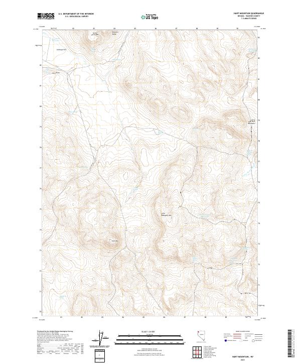
2021 Map of Hart Mountain
USGS Topo · Published 2021About this map
Hart Mtn and the Massacre Range dominate this high-desert portion of Washoe County, where life revolves around isolated water sources and canyon drainages. The landscape is characterized by its numerous natural springs and small upland reservoirs, suggesting a long history of livestock grazing and land use in this arid region. Key watering points like Nellie Spring and Fern Point Spring are scattered across the terrain, while larger topographic features such as Antelope Flat and Little Mahogany Mtn provide significant landmarks. Road access is limited to a few secondary routes including Hart Camp Rd and High Rock Canyon Rd, which navigate the elevation changes between the Little High Rock Mountains and the creek beds of Yellow Rock Canyon Cr. This survey provides a precise accounting of these vital water features, including the Americum Reservoir and Little Mahogany Reservoir, in a landscape where their presence dictates the geography of the range.
Find a feature on this map
32 named features on this map. Tap any name to fly to it.
Don’t see what you’re looking for? This feature index may not catch every label — zoom into the map to look around manually.
Map Details
Editions of this 2021 Hart Mountain Map
This is the sole edition of this map. No revisions or reprints were ever made.
Other maps of this area

1889 · Long Valley
USGS Topo · 1:250,000

1954 · Vya
USGS Topo · 1:250,000

1958 · Vya
USGS Topo · 1:250,000

1962 · Vya
USGS Topo · 1:250,000

1972 · Mahogany Mtn
USGS Topo · 1:24,000
1972 · Yellow Hills West
USGS Topo · 1:24,000

1978 · Hart Mountain
USGS Topo · 1:24,000
1979 · Powers Well
USGS Topo · 1:24,000
1979 · Nellie Spring Mtn
USGS Topo · 1:24,000

1979 · Butte Spring
USGS Topo · 1:24,000