
1931 Map of Hart NW
USGS Topo · Published 1931About this map
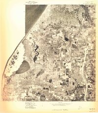
The Lake Michigan shoreline of Oceana County is anchored by the prominent headland of Little Point Sable, where the Little Pt Sable Ch stands near the dunes. Inland, the landscape of the 1930s is a patchwork of small-scale agriculture and woodlots, connected by a network of rural schoolhouses such as Peach Ridge Sch, Batham Sch, and Silver Lake Sch. The Pere Marquette railroad cuts through the eastern portion of the map, serving the village of Mears and facilitating the regional movement of timber and farm goods. This early survey, compiled in part from Air Corps aerial photographs, shows a reliance on water resources for drainage and transit, featuring the Drainage Ditch and Au Sable Creek. Numerous small bodies of water like Round Lake and Morris Lake dot the interior, illustrating the post-glacial topography of the Golden and Pentwater townships.
Find a feature on this map
32 named features on this map. Tap any name to fly to it.
Don’t see what you’re looking for? This feature index may not catch every label — zoom into the map to look around manually.
Map Details
Editions of this 1931 Hart NW Map
This is the sole edition of this map. No revisions or reprints were ever made.
Other maps of this area

1931 · Hart SE
USGS Topo · 1:31,680

1931 · Hart NE
USGS Topo · 1:31,680

1932 · Ludington SW
USGS Topo · 1:31,680

1932 · Ludington SE
USGS Topo · 1:31,680

1954 · Milwaukee
USGS Topo · 1:250,000

1958 · Milwaukee
USGS Topo · 1:250,000

1959 · Ludington
USGS Topo · 1:62,500

1959 · Hart
USGS Topo · 1:62,500
1976 · Hart NW
USGS Topo · 1:24,000
1976 · Hart SE
USGS Topo · 1:24,000