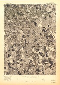
1976 Map of Hart SE
USGS Topo · Published 1976About this map
Shelby, New Era, and Rothbury form a distinct north-south corridor of settlements within this mid-1970s orthophotoquad. The landscape is defined by an intricate patchwork of agricultural fields and woodlots, revealing the intensive land use and rural development patterns of Oceana County during this era. Unlike traditional topographic maps, this aerial perspective provides a literal view of the vegetation density and farmstead placements as they existed on May 8, 1976. The concentration of structures and cleared land around the three primary settlements illustrates the region’s reliance on the transportation lines connecting these communities. The contrast between the organized geometry of the orchards and fields and the scattered natural woodlots across the eastern half of the map highlights the area's agricultural character.
Find a feature on this map
3 named features on this map. Tap any name to fly to it.
Don’t see what you’re looking for? This feature index may not catch every label — zoom into the map to look around manually.
Map Details
Editions of this 1976 Hart SE Map
This is the sole edition of this map. No revisions or reprints were ever made.
Other maps of this area

1929 · Montague
USGS Topo · 1:48,000

1931 · Hart NW
USGS Topo · 1:31,680

1931 · Hart SE
USGS Topo · 1:31,680

1931 · Hart NE
USGS Topo · 1:31,680

1931 · Walkerville SW
USGS Topo · 1:31,680

1931 · Walkerville NW
USGS Topo · 1:31,680

1954 · Milwaukee
USGS Topo · 1:250,000

1958 · Milwaukee
USGS Topo · 1:250,000

1958 · Hesperia
USGS Topo · 1:62,500

1958 · Twin Lake
USGS Topo · 1:62,500