
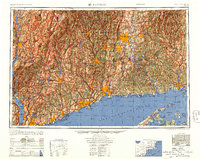
1947 Map of Hartford
USGS Topo · Published 1955About this map
Hartford and the industrial corridors of the Connecticut River valley define this regional study, published shortly after the Second World War. The map details a densely networked landscape where the New York New Haven & Hartford RR and early parkways like the Merritt Parkway connect established manufacturing centers in Waterbury, New Britain, and Bridgeport. Along the coast of Long Island Sound, maritime infrastructure is prominent, from the New London Lighthouse to the critical Submarine Base and the U.S. Coast Guard Academy.
Find a feature on this map
261 named features on this map. Tap any name to fly to it.
Don’t see what you’re looking for? This feature index may not catch every label — zoom into the map to look around manually.
Map Details
Editions of this 1947 Hartford Map
2 editions found
Other maps of this area

1885 · Sheffield
USGS Topo · 1:62,500

1886 · Springfield
USGS Topo · 1:62,500

1887 · Brookfield
USGS Topo · 1:62,500

1887 · Palmer
USGS Topo · 1:62,500

1887 · Granville
USGS Topo · 1:62,500

1888 · Sheffield
USGS Topo · 1:62,500

1888 · Sandisfield
USGS Topo · 1:62,500

1888 · Paterson
USGS Topo · 1:62,500

1889 · Springfield
USGS Topo · 1:62,500

1889 · Stonington
USGS Topo · 1:62,500