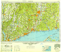
1948 Map of Hartford
USGS Topo · Published 1948About this map
The industrial centers of southern New England and the lower Hudson Valley appear in transition during this postwar survey. Major urban hubs like Hartford, New Haven, and Bridgeport are shown alongside the early modern highway network, including the Merritt Parkway and Wilbur Cross Parkway. Along the coastline of Long Island Sound, the map details a heavy military presence at the eastern entrance, with Fort Terry, Fort Michie, and Fort H. G. Wright guarding the approaches to New London.
Find a feature on this map
339 named features on this map. Tap any name to fly to it.
Don’t see what you’re looking for? This feature index may not catch every label — zoom into the map to look around manually.
Map Details
Editions of this 1948 Hartford Map
2 editions found

Other maps of this area

1885 · Sheffield
USGS Topo · 1:62,500

1886 · Springfield
USGS Topo · 1:62,500

1887 · Brookfield
USGS Topo · 1:62,500

1887 · Palmer
USGS Topo · 1:62,500

1887 · Granville
USGS Topo · 1:62,500

1888 · Sheffield
USGS Topo · 1:62,500

1888 · Sandisfield
USGS Topo · 1:62,500

1888 · Paterson
USGS Topo · 1:62,500

1889 · Springfield
USGS Topo · 1:62,500

1889 · Stonington
USGS Topo · 1:62,500