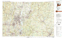
1994 Map of Hartford
USGS Topo · Published 1995About this map
The Connecticut River bisects this 1994 regional study, serving as the central artery for the dense urban corridor stretching from Hartford and East Hartford through to Middletown. The landscape is a complex mix of industrial centers like New Britain and Bristol, and sprawling academic and institutional landmarks including Trinity College, Wesleyan University, and the University of Connecticut. Transport infrastructure dominates the valley, with Interstate 91 and Amtrak lines paralleling the river, while Bradley International Airport and Brainard Field anchor the region's aviation hub.
Find a feature on this map
125 named features on this map. Tap any name to fly to it.
Don’t see what you’re looking for? This feature index may not catch every label — zoom into the map to look around manually.
Map Details
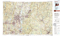
Editions of this 1994 Hartford Map
2 editions found
Other maps of this area

1886 · Springfield
USGS Topo · 1:62,500

1887 · Brookfield
USGS Topo · 1:62,500

1887 · Palmer
USGS Topo · 1:62,500

1887 · Granville
USGS Topo · 1:62,500

1888 · Sandisfield
USGS Topo · 1:62,500

1889 · Springfield
USGS Topo · 1:62,500

1889 · Stonington
USGS Topo · 1:62,500

1889 · Derby
USGS Topo · 1:62,500

1889 · Webster
USGS Topo · 1:62,500

1889 · Putnam
USGS Topo · 1:62,500