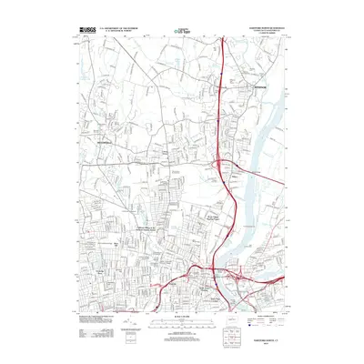
2012 Map of Hartford North
USGS Topo · Published 2012About this map
Windsor and the northern reaches of Hartford are defined here by the confluence of the Farmington River and the Connecticut River. This 2012 topographic survey documents a dense urban and suburban landscape shaped by historic institutions and major transportation corridors. The capital city's heritage is visible through sites like the Childrens Village of the Hartford Orphan Asylum and the Ancient Cem, while the Soldiers and Sailors Memorial Arch stands as a local landmark. The map detail highlights the city's academic landscape, including the University of Hartford, Saint Josephs College, and several campuses for the University of Connecticut. Along the waterfront, the Bulkeley Bridge and Founders Bridge connect to East Hartford, while the North Meadows Dike and Colt Pier illustrate the long-standing management of the river's edge. Residential developments like the Stowe Village Housing Project and Dutch Point Colony provide clear markers for community history and urban planning researchers.
Find a feature on this map
56 named features on this map. Tap any name to fly to it.
Don’t see what you’re looking for? This feature index may not catch every label — zoom into the map to look around manually.
Map Details
Editions of this 2012 Hartford North Map
This is the sole edition of this map. No revisions or reprints were ever made.
Other maps of this area

1892 · Hartford
USGS Topo · 1:62,500

1892 · Meriden
USGS Topo · 1:62,500

1892 · Granby
USGS Topo · 1:62,500

1893 · Middletown
USGS Topo · 1:62,500

1893 · Meriden
USGS Topo · 1:62,500

1906 · Farmington
USGS Topo · 1:125,000

1928 · Windsor Locks
USGS Topo · 1:24,000

1928 · Windsor
USGS Topo · 1:24,000

1928 · Glastonbury
USGS Topo · 1:24,000

1928 · Broad Brook
USGS Topo · 1:24,000