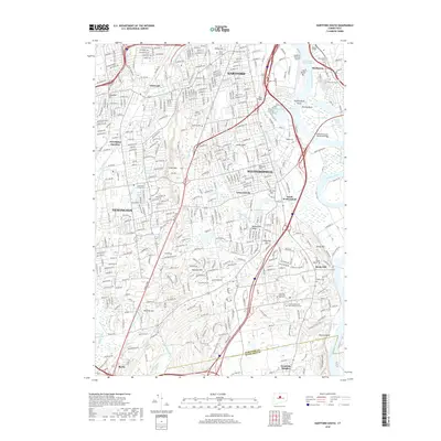
2018 Map of Hartford South
USGS Topo · Published 2018About this map
Hartford and its southern suburbs appear here in significant detail, anchored by the academic grounds of Trinity College and the riverside facilities of Hartford-Brainard Airport. The landscape is defined by the sweeping curves of the Connecticut River and its intricate secondary waterways like Wethersfield Cove and Willow Brook. To the west, the prominent rise of Cedar Mtn and the Metacomet Ridge provide a natural barrier that influenced the development of Newington and Wethersfield. Extensive cemetery grounds, including the historic Cedar Hill Cem and the Colonel Raymond F Gates Memorial Cem, reflect the long-standing community footprint in this corridor. The map highlights a complex infrastructure of bridges and thoroughfares, such as the William Putnam Memorial Bridge and the busy Berlin Tpke, connecting residential centers like Griswoldville and South Wethersfield with the urban core of the state capital.
Find a feature on this map
65 named features on this map. Tap any name to fly to it.
Don’t see what you’re looking for? This feature index may not catch every label — zoom into the map to look around manually.
Map Details
Editions of this 2018 Hartford South Map
This is the sole edition of this map. No revisions or reprints were ever made.
Other maps of this area

1892 · Hartford
USGS Topo · 1:62,500

1892 · Meriden
USGS Topo · 1:62,500

1892 · Granby
USGS Topo · 1:62,500

1893 · Middletown
USGS Topo · 1:62,500

1893 · Meriden
USGS Topo · 1:62,500

1906 · Farmington
USGS Topo · 1:125,000

1928 · Cromwell
USGS Topo · 1:24,000

1928 · Windsor
USGS Topo · 1:24,000

1928 · Glastonbury
USGS Topo · 1:24,000

1928 · Manchester
USGS Topo · 1:24,000