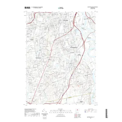
2021 Map of Hartford South
USGS Topo · Published 2021About this map
Hartford and its southern suburbs occupy a landscape defined by the wide curves of the Connecticut River and the basalt rise of Metacomet Ridge. This modern survey illustrates the dense residential and educational fabric of the region, anchored by institutions like Trinity College and Goodwin College. The river's influence is clear at Wethersfield Cove and Keeney Cove, where recreational waters meet the industrial footprint of Hartford-Brainard Airport.
Find a feature on this map
80 named features on this map. Tap any name to fly to it.
Don’t see what you’re looking for? This feature index may not catch every label — zoom into the map to look around manually.
Map Details
Editions of this 2021 Hartford South Map
This is the sole edition of this map. No revisions or reprints were ever made.
Other maps of this area

1892 · Hartford
USGS Topo · 1:62,500

1892 · Meriden
USGS Topo · 1:62,500

1892 · Granby
USGS Topo · 1:62,500

1893 · Middletown
USGS Topo · 1:62,500

1893 · Meriden
USGS Topo · 1:62,500

1906 · Farmington
USGS Topo · 1:125,000

1928 · Cromwell
USGS Topo · 1:24,000

1928 · Windsor
USGS Topo · 1:24,000

1928 · Glastonbury
USGS Topo · 1:24,000

1928 · Manchester
USGS Topo · 1:24,000