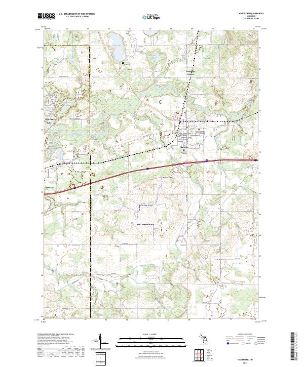
2023 Map of Hartford
USGS Topo · Published 2023About this map
Hartford serves as the central hub of this modern survey, where the grid-iron streets of the town meet the meandering path of the Paw Paw River. The landscape is a mix of agricultural tracts and preserved natural corridors, notably the Van Buren Trail State Park Trl which follows a former rail alignment through the township. For those researching local heritage, several significant burial sites are documented, including the Rush Lake Indian Cem near the shores of Rush Lake and the Maple Hill Cem on the outskirts of town. The area’s water network is densely mapped, featuring Pine Creek, Hog Creek, and Mill Creek, alongside smaller bodies like Sassafras Lake and Sherwood Lake. The western edge of the map transitions into Berrien County, capturing the municipal facilities of Watervliet and the Watervliet Municipal Airport.
Find a feature on this map
49 named features on this map. Tap any name to fly to it.
Don’t see what you’re looking for? This feature index may not catch every label — zoom into the map to look around manually.
Map Details
Editions of this 2023 Hartford Map
This is the sole edition of this map. No revisions or reprints were ever made.
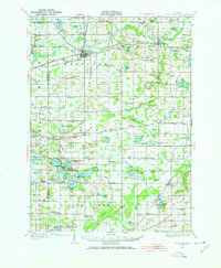
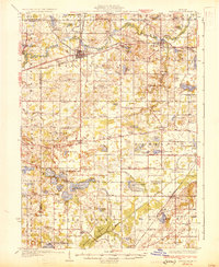
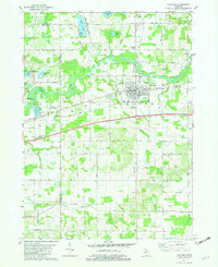
Historical Maps of Keeler Township Through Time
4 maps found