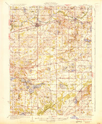
1931 Map of Hartford
USGS Topo · Published 1931About this map
Hartford and Lawrence serve as the primary hubs in this Van Buren County landscape, where the Pere Marquette railroad follows the winding course of the Paw Paw River. The western portion of the map is defined by a dense concentration of glacial lakes, including the sprawling Magician Lake and the Sister Lakes cluster, which by the early 1930s had already begun developing as recreational destinations like Woodland Beach. Smaller rural hamlets such as Keeler and Glenwood anchor the southern townships, connected by a network of early motor routes like the Territorial Road.
Find a feature on this map
95 named features on this map. Tap any name to fly to it.
Don’t see what you’re looking for? This feature index may not catch every label — zoom into the map to look around manually.
Map Details
Editions of this 1931 Hartford Map
2 editions found
Other maps of this area

1927 · Niles
USGS Topo · 1:62,500

1927 · Hartford
USGS Topo · 1:62,500

1927 · Bangor
USGS Topo · 1:62,500

1927 · Benton Harbor
USGS Topo · 1:62,500

1927 · South Haven
USGS Topo · 1:62,500

1930 · South Haven
USGS Topo · 1:62,500

1930 · Benton Harbor
USGS Topo · 1:62,500

1930 · Niles
USGS Topo · 1:62,500

1931 · Bangor
USGS Topo · 1:62,500

1931 · Hartford
USGS Topo · 1:62,500