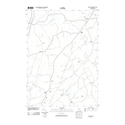
2010 Map of Hartford
USGS Topo · Published 2010About this map
Hartford and its surrounding hamlets in Washington County are defined by a landscape of rolling hills and winding watercourses. The western edge is marked by the industrious corridor of the Champlain Canal near Smiths Basin, while the interior is crisscrossed by numerous brooks like Big Creek and Moses Kill. Small agricultural and residential clusters including South Hartford, Adamsville, and The Hook dot the terrain, linked by a network of rural routes such as Co Rte 43 and Co Rd 30.
Find a feature on this map
70 named features on this map. Tap any name to fly to it.
Don’t see what you’re looking for? This feature index may not catch every label — zoom into the map to look around manually.
Map Details
Editions of this 2010 Hartford Map
This is the sole edition of this map. No revisions or reprints were ever made.
Other maps of this area

1893 · Fort Ann
USGS Topo · 1:62,500

1895 · Cambridge
USGS Topo · 1:62,500

1895 · Fort Ann
USGS Topo · 1:62,500

1895 · Glens Falls
USGS Topo · 1:62,500

1897 · Glens Falls
USGS Topo · 1:62,500

1898 · Cambridge
USGS Topo · 1:62,500

1898 · Fort Ann
USGS Topo · 1:62,500

1900 · Schuylerville
USGS Topo · 1:62,500

1901 · Fort Ann
USGS Topo · 1:62,500

1901 · Cambridge
USGS Topo · 1:62,500