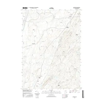
2016 Map of Hartford
USGS Topo · Published 2016About this map
Hartford and South Hartford anchor this rural landscape in Washington County, where the topography transitions from the lowlands of Tamarack Swamp to the prominent heights of Christian Hill and Black Mtn. The area is characterized by a high concentration of family-linked landmarks and early burial grounds, such as the Old North Argyle Cem and Adamsville Cem, which offer significant value for genealogical research. The drainage patterns of Big Creek and Wood Creek dictate the layout of the local road network, which connects scattered hamlets like Belcher and Adamsville. This survey illustrates the modern persistence of a traditional agricultural and small-town structure, punctuated by specialized aviation sites including Mountain View Airport and Argyle Airport. The map detail effectively preserves the 21st-century footprint of these longstanding communities, from the residential clusters at North Argyle to the outlying ridges of Pumpkin Hill.
Find a feature on this map
90 named features on this map. Tap any name to fly to it.
Don’t see what you’re looking for? This feature index may not catch every label — zoom into the map to look around manually.
Map Details
Editions of this 2016 Hartford Map
This is the sole edition of this map. No revisions or reprints were ever made.
Other maps of this area

1893 · Fort Ann
USGS Topo · 1:62,500

1895 · Cambridge
USGS Topo · 1:62,500

1895 · Fort Ann
USGS Topo · 1:62,500

1895 · Glens Falls
USGS Topo · 1:62,500

1897 · Glens Falls
USGS Topo · 1:62,500

1898 · Cambridge
USGS Topo · 1:62,500

1898 · Fort Ann
USGS Topo · 1:62,500

1900 · Schuylerville
USGS Topo · 1:62,500

1901 · Fort Ann
USGS Topo · 1:62,500

1901 · Cambridge
USGS Topo · 1:62,500