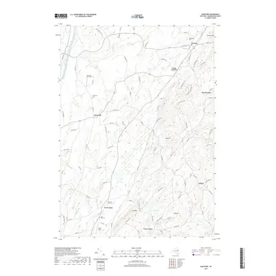
2019 Map of Hartford
USGS Topo · Published 2019About this map
The agricultural and upland terrain of Washington County dominates this survey, where the valley of Wood Creek meets the rising slopes of Black Mtn and Mt Rascal. Small hamlets and crossroads like Adamsville and North Argyle anchor the rural landscape, connected by a network of local routes including Co Rd 30 and Scott Hill Rd. The map reveals a high density of family and community history, evidenced by several dedicated burial grounds such as Adamsville Cem and the Old North Argyle Cem.
Find a feature on this map
92 named features on this map. Tap any name to fly to it.
Don’t see what you’re looking for? This feature index may not catch every label — zoom into the map to look around manually.
Map Details
Editions of this 2019 Hartford Map
This is the sole edition of this map. No revisions or reprints were ever made.
Other maps of this area

1893 · Fort Ann
USGS Topo · 1:62,500

1895 · Cambridge
USGS Topo · 1:62,500

1895 · Fort Ann
USGS Topo · 1:62,500

1895 · Glens Falls
USGS Topo · 1:62,500

1897 · Glens Falls
USGS Topo · 1:62,500

1898 · Cambridge
USGS Topo · 1:62,500

1898 · Fort Ann
USGS Topo · 1:62,500

1900 · Schuylerville
USGS Topo · 1:62,500

1901 · Fort Ann
USGS Topo · 1:62,500

1901 · Cambridge
USGS Topo · 1:62,500