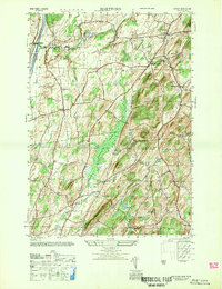
1947 Map of Hartford
USGS Topo · Published 1947About this map
Hartford and the village of South Hartford anchor this 1947 topographic study of Washington County, showing a landscape defined by the drainage of Big Creek and Moses Kill. The northwestern corner is dominated by the Barge Canal near Smiths Basin, a critical piece of New York transportation infrastructure. Moving eastward, the terrain transitions from the lowlands of Tamarack Swamp into the high ground of Black Mtn and Mt Rascal. The map reveals a dense network of local roads connecting small hamlets such as Adamsville, where the Adamsville Cem is a notable landmark for genealogical research. Other rural focal points include the Salem Sch and the community of The Hook. The settlement pattern follows the contours of the hills and the winding paths of Gettys Brook, illustrating a mid-century agricultural region before the expansion of modern highway systems.
Find a feature on this map
24 named features on this map. Tap any name to fly to it.
Don’t see what you’re looking for? This feature index may not catch every label — zoom into the map to look around manually.
Map Details
Editions of this 1947 Hartford Map
This is the sole edition of this map. No revisions or reprints were ever made.
Other maps of this area

1893 · Fort Ann
USGS Topo · 1:62,500

1895 · Cambridge
USGS Topo · 1:62,500

1895 · Fort Ann
USGS Topo · 1:62,500

1895 · Glens Falls
USGS Topo · 1:62,500

1897 · Glens Falls
USGS Topo · 1:62,500

1898 · Cambridge
USGS Topo · 1:62,500

1898 · Fort Ann
USGS Topo · 1:62,500

1900 · Schuylerville
USGS Topo · 1:62,500

1901 · Fort Ann
USGS Topo · 1:62,500

1901 · Cambridge
USGS Topo · 1:62,500