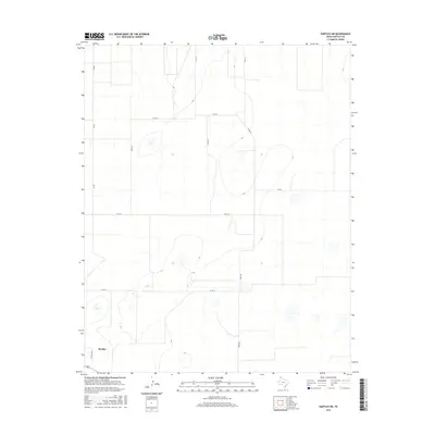
2016 Map of Hartley NE
USGS Topo · Published 2016About this map
Hartley is the primary settlement on this landscape in the Texas Panhandle, positioned near the southwestern corner where the regional grid of ranch and farm roads converges. This 2016 survey illustrates the organized land partitioning of Hartley County, characterized by expansive sections defined by routes such as Fm 807 and Fm 3422. The terrain is marked by numerous small depressions and intermittent catchments that dot the high plains, typical of the Llano Estacado's drainage patterns. Local transit is facilitated by named thoroughfares including Fords Rd, Rafter J Rd, and Gore Rd, which reflect the ranching heritage and private landholdings of the area. The map serves as a contemporary record of rural infrastructure, tracing the paths of Co Rd G and Co Rd K through the open country northeast of the townsite.
Find a feature on this map
13 named features on this map. Tap any name to fly to it.
Don’t see what you’re looking for? This feature index may not catch every label — zoom into the map to look around manually.
Map Details
Editions of this 2016 Hartley NE Map
This is the sole edition of this map. No revisions or reprints were ever made.
Other maps of this area

1954 · Tucumcari
USGS Topo · 1:250,000

1954 · Dalhart
USGS Topo · 1:250,000

1958 · Tucumcari
USGS Topo · 1:250,000

1958 · Dalhart
USGS Topo · 1:250,000

1962 · Dalhart
USGS Topo · 1:250,000

1963 · Hartley SE
USGS Topo · 1:24,000

1963 · Hartley NE
USGS Topo · 1:24,000

1963 · Bird Ranch Store
USGS Topo · 1:24,000

1963 · Moran Ranch
USGS Topo · 1:24,000

1965 · Wilco
USGS Topo · 1:24,000