
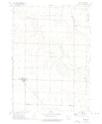
1970 Map of Hartley
USGS Topo · Published 1972About this map
The agricultural hub of Hartley serves as the focal point for this survey of the northern Iowa prairie. Located in O'Brien County, the town is defined by its intersection of major transportation routes, including the Chicago Milwaukee St Paul and Pacific and the Chicago Rock Island and Pacific railroads. These lines, which converge near the local Sewage Disposal plant and Pleasant View Cemetery, highlight the era's reliance on rail for moving grain and livestock from the surrounding townships of Omega and Lone Tree.
Find a feature on this map
24 named features on this map. Tap any name to fly to it.
Don’t see what you’re looking for? This feature index may not catch every label — zoom into the map to look around manually.
Map Details
Editions of this 1970 Hartley Map
This is the sole edition of this map. No revisions or reprints were ever made.
Other maps of this area

1954 · Fairmont
USGS Topo · 1:250,000

1958 · Fairmont
USGS Topo · 1:250,000

1964 · Plessis
USGS Topo · 1:24,000

1964 · Gaza
USGS Topo · 1:24,000

1970 · Hartley SW
USGS Topo · 1:24,000

1970 · Everly
USGS Topo · 1:24,000

1970 · Royal
USGS Topo · 1:24,000

1970 · Lake Park SE
USGS Topo · 1:24,000

1970 · May City
USGS Topo · 1:24,000
1972 · Melvin
USGS Topo · 1:24,000