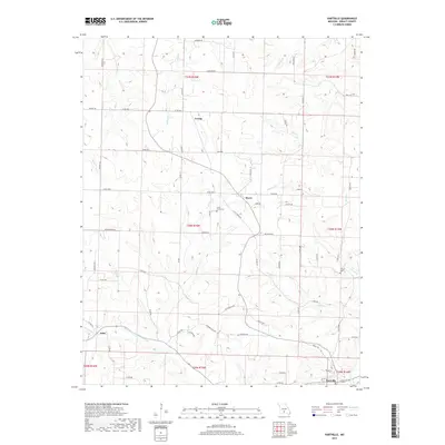
2017 Map of Hartville
USGS Topo · Published 2017About this map
Hartville serves as the primary focal point of this Wright County landscape, situated along the Woods Fork Gasconade River in southern Missouri. The terrain is defined by a dense network of tributaries including Indian Cr, Elk Cr, and Steins Cr, which carve through the countryside. Smaller rural centers such as Boyer, Loring, and Odin are connected by a web of county roads and state highways, reflecting a long-standing agricultural and residential pattern. Genealogists will find interest in the documented locations of Little Creek Cem and Krause Cem, which stand as markers of local family history near the banks of Little Cr and Brush Cr. The map's layout illustrates how early 20th-century township boundaries and section lines continue to dictate the modern property and road configurations across the region.
Find a feature on this map
73 named features on this map. Tap any name to fly to it.
Don’t see what you’re looking for? This feature index may not catch every label — zoom into the map to look around manually.
Map Details
Editions of this 2017 Hartville Map
This is the sole edition of this map. No revisions or reprints were ever made.
Other maps of this area

1931 · Manes
USGS Topo · 1:48,000

1941 · Manes
USGS Topo · 1:62,500

1943 · Manes
USGS Topo · 1:62,500

1951 · Owens
USGS Topo · 1:24,000

1951 · Mansfield NE
USGS Topo · 1:24,000

1951 · Mansfield NW
USGS Topo · 1:24,000

1951 · Mountain Grove
USGS Topo · 1:62,500

1954 · Springfield
USGS Topo · 1:250,000

1956 · Duncan
USGS Topo · 1:24,000

1956 · Rader
USGS Topo · 1:24,000