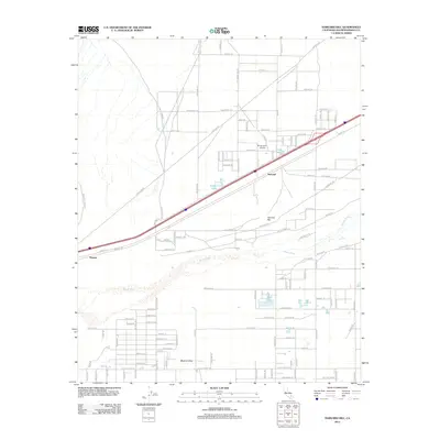
2012 Map of Harvard Hill
USGS Topo · Published 2012About this map
Harvard and the sprawling residential layout of Mojave Valley occupy this high desert landscape in San Bernardino County. The area is defined by a grid of long desert roads such as Yermo Rd and Mannix Rd, which parallel the path of the Mojave River as it passes south of Harvard Hill. This 2012 survey illustrates a transition in the valley's development, where modern aviation infrastructure at the Harvard Airport sits near small artificial water bodies like Lake Tami, Dolores Lake, and Lake Jodie. The map provides a look at the desert's mid-century into 21st-century settlement patterns, including the smaller rail-adjacent site of Toomey and the planned but sparsely populated street network of Twin Lakes.
Find a feature on this map
58 named features on this map. Tap any name to fly to it.
Don’t see what you’re looking for? This feature index may not catch every label — zoom into the map to look around manually.
Map Details
Editions of this 2012 Harvard Hill Map
This is the sole edition of this map. No revisions or reprints were ever made.
Other maps of this area

1933 · Avawatz Mountains
USGS Topo · 1:250,000

1947 · Trona
USGS Topo · 1:250,000

1948 · Trona
USGS Topo · 1:250,000

1948 · Alvord Mountain
USGS Topo · 1:62,500

1948 · Lane Mountain
USGS Topo · 1:62,500

1951 · Alvord Mountain
USGS Topo · 1:62,500

1951 · Lane Mountain
USGS Topo · 1:62,500

1953 · San Bernardino
USGS Topo · 1:250,000

1953 · Yermo
USGS Topo · 1:24,000

1953 · Trona
USGS Topo · 1:250,000