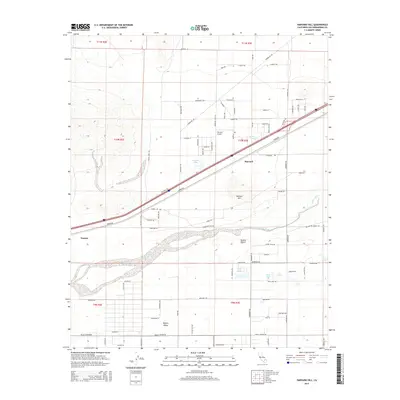
2015 Map of Harvard Hill
USGS Topo · Published 2015About this map
Harvard sits as the central settlement in this portion of the Mojave Desert, where the high desert landscape is defined by the ephemeral path of the Mojave River. This 2015 survey reveals a specialized aviation and water-focused geography, featuring the Harvard Airport and a series of small water bodies like Dolores Lake, Lake Tami, and Lake Jodie that stand out against the arid terrain. The layout of the Mojave Valley in the south is marked by a rigorous grid of residential streets such as Kiloran St and Bedford Rd, contrasting with the more isolated settlement at Toomey. Transportation through the region is anchored by the prominent corridor of Yermo Rd, which parallels the railroad, while the eponymous Harvard Hill provides a distinct topographic landmark amidst the surrounding flats. The presence of several small lakes and named desert tracks illustrates the localized development and infrastructure supporting this desert community.
Find a feature on this map
53 named features on this map. Tap any name to fly to it.
Don’t see what you’re looking for? This feature index may not catch every label — zoom into the map to look around manually.
Map Details
Editions of this 2015 Harvard Hill Map
This is the sole edition of this map. No revisions or reprints were ever made.
Other maps of this area

1933 · Avawatz Mountains
USGS Topo · 1:250,000

1947 · Trona
USGS Topo · 1:250,000

1948 · Trona
USGS Topo · 1:250,000

1948 · Alvord Mountain
USGS Topo · 1:62,500

1948 · Lane Mountain
USGS Topo · 1:62,500

1951 · Alvord Mountain
USGS Topo · 1:62,500

1951 · Lane Mountain
USGS Topo · 1:62,500

1953 · San Bernardino
USGS Topo · 1:250,000

1953 · Yermo
USGS Topo · 1:24,000

1953 · Trona
USGS Topo · 1:250,000