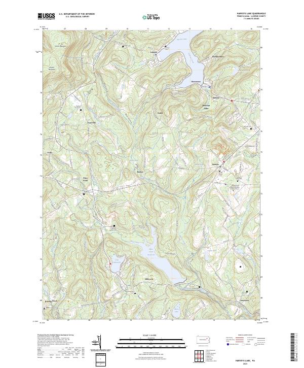
2023 Map of Harveys Lake
USGS Topo · Published 2023About this map
Harveys Lake dominates the northeastern landscape of this Luzerne County survey, surrounded by a network of summer settlements and permanent communities like Laketon, Shawanese, and Idetown. The terrain transitions from the high elevations of North Mountain and Kocher Mountain in the northwest down toward the intricate valley of Harveys Creek. This area serves as a significant watershed, managed through the Pikes Creek Reservoir and smaller bodies such as Lake Silkworth and Moon Lake.
Find a feature on this map
141 named features on this map. Tap any name to fly to it.
Don’t see what you’re looking for? This feature index may not catch every label — zoom into the map to look around manually.
Map Details
Editions of this 2023 Harveys Lake Map
This is the sole edition of this map. No revisions or reprints were ever made.
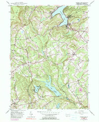
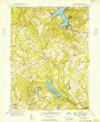
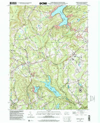
Historical Maps of Jackson Township Through Time
5 maps found