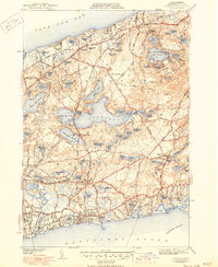
1943 Map of Harwich
USGS Topo · Published 1950About this map
Brewster and Harwich define this coastal landscape, which stretches from the shoreline of Cape Cod Bay south to Nantucket Sound. During this period, the region's transport network was anchored by the New Haven and Hartford RR, which connected the various villages of the Lower Cape, from West Brewster down to West Harwich. The interior of the quadrangle is dominated by a dense concentration of kettle ponds, including the expansive Long Pond, Seymour Pond, and Hinckleys Pond, while Nickerson State Park preserves the wooded terrain surrounding Cliff Pond.
Find a feature on this map
133 named features on this map. Tap any name to fly to it.
Don’t see what you’re looking for? This feature index may not catch every label — zoom into the map to look around manually.
Map Details
Editions of this 1943 Harwich Map
3 editions found
Other maps of this area

1887 · Wellfleet
USGS Topo · 1:62,500

1887 · Yarmouth
USGS Topo · 1:62,500

1888 · Chatham
USGS Topo · 1:62,500

1889 · Yarmouth
USGS Topo · 1:62,500

1889 · Wellfleet
USGS Topo · 1:62,500

1893 · Chatham
USGS Topo · 1:62,500

1893 · Yarmouth
USGS Topo · 1:62,500

1893 · Wellfleet
USGS Topo · 1:62,500

1917 · Chatham
USGS Topo · 1:62,500

1942 · Cape Cod Bay
USGS Topo · 1:125,000