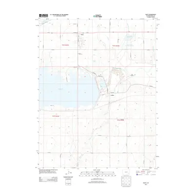
2013 Map of Hasty
USGS Topo · Published 2013About this map
John Martin Reservoir dominates the landscape of this Bent County survey, illustrating the critical role of water management in eastern Colorado. The reservoir, formed by a dam on the Arkansas River, sits at the center of a complex network of agricultural infrastructure, including the Fort Lyon Canal, Lubers Drainage Ditch, and Levee Ditch. The settlement of Hasty serves as a local hub near the shoreline of Lake Hasty, while the smaller community of Caddoa is situated to the southeast along the banks of Caddoa Cr. For genealogists and local historians, the Union Valley Cem and family-named landmarks like Verhoeff Spring or the G W Verhoeff Reservoir provide concrete links to the families who established themselves in this arid environment. The map also captures the varied terrain of the High Plains, from the riparian woodland of Big Timbers to the winding course of Limestone Cr.
Find a feature on this map
41 named features on this map. Tap any name to fly to it.
Don’t see what you’re looking for? This feature index may not catch every label — zoom into the map to look around manually.
Map Details
Editions of this 2013 Hasty Map
This is the sole edition of this map. No revisions or reprints were ever made.
Other maps of this area

1891 · Higbee
USGS Topo · 1:125,000

1891 · Las Animas
USGS Topo · 1:125,000

1892 · Lamar
USGS Topo · 1:125,000

1892 · Two Butte
USGS Topo · 1:125,000

1893 · Higbee
USGS Topo · 1:125,000

1893 · Two Butte
USGS Topo · 1:125,000

1893 · Las Animas
USGS Topo · 1:125,000

1953 · Hasty
USGS Topo · 1:24,000

1953 · Prowers
USGS Topo · 1:24,000

1953 · Kreybill
USGS Topo · 1:24,000