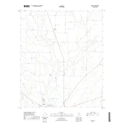
2019 Map of Hatchel
USGS Topo · Published 2019About this map
Ballinger occupies the southern edge of this West Texas landscape, where the northern residential and street grids meet the riparian systems of the Colorado River basin. The terrain is defined by an intricate network of drainages such as Elm Creek, Coyote Cr, and Rattlesnake Cr, illustrating the complex hydrology of Runnels County. Further north, the settlement of Hatchel serves as a local hub along the highway, surrounded by a dense grid of county roads that speak to the region's agricultural parceling. Genealogists and local historians will find the Old Runnels Cem near Elm Creek, a significant site marking the early settlement patterns of the area. The map captures the convergence of numerous branches and creeks, including Bears Foot Cr and Antelope Cr, which highlight the natural landmarks used by generations of ranchers and farmers in this section of the state.
Find a feature on this map
58 named features on this map. Tap any name to fly to it.
Don’t see what you’re looking for? This feature index may not catch every label — zoom into the map to look around manually.
Map Details
Editions of this 2019 Hatchel Map
This is the sole edition of this map. No revisions or reprints were ever made.
Other maps of this area

1891 · Hayrick
USGS Topo · 1:125,000

1892 · Ballinger
USGS Topo · 1:125,000

1894 · Hayrick
USGS Topo · 1:125,000

1921 · Hatchel
USGS Topo · 1:31,680

1921 · Quarry Creek
USGS Topo · 1:31,680

1921 · Spur Creek
USGS Topo · 1:31,680

1921 · Rowena
USGS Topo · 1:31,680

1932 · Paint Rock
USGS Topo · 1:62,500

1954 · Brownwood
USGS Topo · 1:250,000

1954 · San Angelo
USGS Topo · 1:250,000