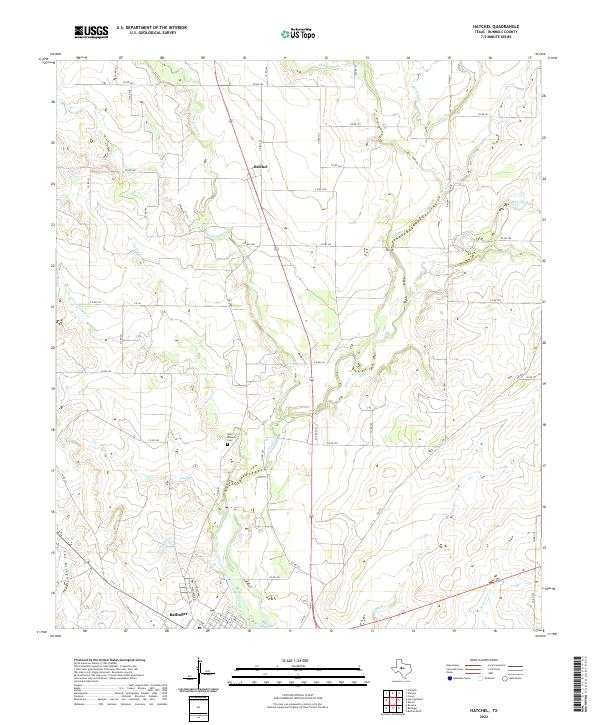
2022 Map of Hatchel
USGS Topo · Published 2022About this map
Hatchel stands as a primary landmark in this rural Runnels County landscape, where the northern edge of Ballinger begins to take shape along Hillcrest Ave and Highland Dr. The terrain is defined by an intricate network of seasonal drainages and creek beds, including Elm Creek, Coyote Cr, and Turkey Cr, which carve through the land north toward Bluff Cr. For those tracing local heritage, the Old Runnels Cem provides a significant point of historical interest near the center of the quadrangle. The map details a transition from the structured street grid of the county seat into a vast system of ranch and county roads, such as Co Rd 342 and FM 382, illustrating the enduring agricultural and pastoral character of this Central Texas region.
Find a feature on this map
58 named features on this map. Tap any name to fly to it.
Don’t see what you’re looking for? This feature index may not catch every label — zoom into the map to look around manually.
Map Details
Editions of this 2022 Hatchel Map
This is the sole edition of this map. No revisions or reprints were ever made.
Other maps of this area

1891 · Hayrick
USGS Topo · 1:125,000

1892 · Ballinger
USGS Topo · 1:125,000

1894 · Hayrick
USGS Topo · 1:125,000

1921 · Hatchel
USGS Topo · 1:31,680

1921 · Quarry Creek
USGS Topo · 1:31,680

1921 · Spur Creek
USGS Topo · 1:31,680

1921 · Rowena
USGS Topo · 1:31,680

1932 · Paint Rock
USGS Topo · 1:62,500

1954 · Brownwood
USGS Topo · 1:250,000

1954 · San Angelo
USGS Topo · 1:250,000