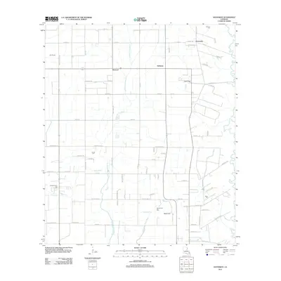
2012 Map of Hathaway
USGS Topo · Published 2012About this map
Hathaway and the surrounding agricultural lands of Jefferson Davis Parish are defined by a sophisticated network of irrigation and drainage canals essential for local rice and crawfish production. This landscape is bisected by the W Bayou Grand Marais and the Middle Bayou Grand Marais, which feed into engineered waterways like the Tiptop Canal. The map reveals a settlement pattern of small communities such as Panchoville and Raymond connected by a dense grid of farm roads. The region's industrial side is represented by the Roanoke Oil and Gas Field and East Roanoke Gas Field, illustrating the dual importance of surface agriculture and subsurface mineral extraction. Local history is anchored by family-named landmarks including Bertrand Cem, Doucet Cem, and Miller Cem, which provide valuable touchstones for genealogists tracing the heritage of this Acadiana prairie region.
Find a feature on this map
51 named features on this map. Tap any name to fly to it.
Don’t see what you’re looking for? This feature index may not catch every label — zoom into the map to look around manually.
Map Details
Editions of this 2012 Hathaway Map
This is the sole edition of this map. No revisions or reprints were ever made.
Other maps of this area

1946 · Mermentau
USGS Topo · 1:31,680

1946 · Jennings
USGS Topo · 1:31,680

1947 · Evangeline
USGS Topo · 1:31,680

1947 · Kinder
USGS Topo · 1:31,680

1947 · Pine Island
USGS Topo · 1:31,680

1947 · Welsh
USGS Topo · 1:31,680

1947 · Elton
USGS Topo · 1:31,680

1947 · Hathaway
USGS Topo · 1:31,680

1947 · Basile
USGS Topo · 1:31,680

1949 · Basile
USGS Topo · 1:31,680